Skytech Cambridge Ltd
Cambridge's Drone Experts - providing expert drone solutions across multiple sectors. Based in Cambridge and serving clients worldwide, we’re dedicated to innovation, accuracy, and a personalised approach for every project.
Skytech Cambridge is a leading provider of innovative drone services, offering tailored solutions for businesses across the UK and internationally. With expertise spanning drone surveys, asset inspections, 3D modelling, thermal imaging, and high-quality filming, we are committed to delivering exceptional results for every project.
Based in Cambridgeshire, we leverage cutting-edge technology and deep industry experience to provide comprehensive drone-based solutions that save time, minimise risk, and reduce costs. Our services include:
Drone Surveys, Inspections & Mapping
Skytech Cambridge delivers fast, accurate, and cost-effective visual oversight of high-level buildings and structures. Our team can typically be deployed for inspections within 24 hours across the UK, delivering high-resolution imagery and secure live streaming to stakeholders worldwide.
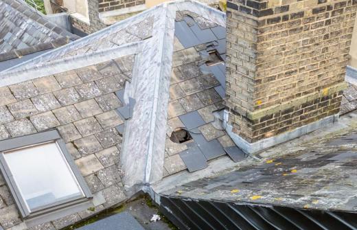
Our drones are designed to access difficult and potentially unsafe areas, enabling us to produce survey-accurate imagery for various projects. From roof surveys and topographic land mapping to precise data capture compatible with BIM, GIS, AutoCAD, and other business systems, we ensure your needs are met to the highest quality standards.
Drone Filming & Photography
With our state-of-the-art fleet of DJI cinema drones, we deliver stunning aerial footage in resolutions up to 8K and frame rates of 120fps. Whether you're looking to create captivating films or visually compelling photography, our drones bring your vision to life.
Additionally, we offer FPV (First-Person View) drone filming for a modern, immersive videography style that adds dynamic energy to any project.
Drone Traffic Surveys
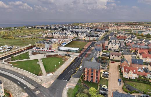
Skytech Cambridge is revolutionising urban planning and traffic management with cutting-edge drone-based traffic surveys. By capturing high-resolution aerial footage and applying state-of-the-art video analytics, we provide invaluable data and behavioural insights. This modern approach empowers planners to address the complexities of traffic dynamics with precision and efficiency.
Drone 2D/3D Scans, Data Capture & 3D Modelling
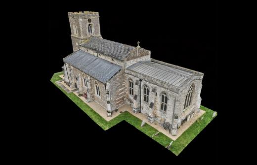
Using advanced photogrammetry techniques and RTK positioning data, our drones create incredibly accurate and detailed 2D and 3D maps. From individual buildings to extensive construction sites or agricultural land, our services offer unparalleled accuracy for design, planning, and analysis.
Drone Thermal Imaging
At Skytech Cambridge, we leverage industry-leading thermal imaging technology to deliver high-resolution radiometric images and video for a wide range of applications. Our expertise includes:
- Building Heat Loss Surveys: Identify areas of heat loss to improve energy efficiency.
- Roof Water Ingress Detection: Pinpoint water leaks and damage with precision.
- Cold Spot Analysis: Detect insulation issues or areas requiring maintenance.
- Solar Panel Inspections: Ensure optimal performance and identify faults in photovoltaic systems.
Our thermal imaging drones are an invaluable tool for roof and building envelope surveys, security oversight, event management, and more. With precise, actionable insights, we help optimise safety, performance, and efficiency across every project.
Drone Security & Event Oversight
Our enterprise-grade drones with secure video transmission systems ensure seamless monitoring of events and assets. With live video feeds accessible from anywhere, we provide real-time situational awareness for security, logistics, and event management needs.
Drone Livestreaming
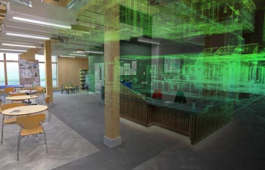
Skytech Cambridge offers low-latency, high-resolution livestreaming using a combination of satellite, cellular, and localised networks. Whether for virtual property tours or live interactive events, we connect you to your audience with stunning clarity.
Drone 360° Panoramas & Time Lapse
We create immersive, fully interactive 360° panoramas and breathtaking drone-based time-lapse media. From capturing the progress of large-scale construction projects to producing visually striking marketing materials, our solutions offer unmatched versatility.
At Skytech Cambridge, our mission is to combine cutting-edge technology with personalised service, providing reliable and efficient drone solutions that exceed expectations. Contact us today to learn how we can elevate your next project.
We believe the best results are achieved through strong and effective collaboration. That’s why we approach every project with a commitment to understanding our clients’ needs and maintaining open communication throughout the process.
As a specialised drone services provider, we combine a passion for cutting-edge technology with industry expertise to deliver efficient, professional, and cost-effective solutions. Our focus on quality and safety ensures that we consistently meet the high standards required for complex, large-scale projects.
Company Director
Products and services
Drone Livestreaming
Low latency high resolution live streaming using a combination of satellite, cellular and localised networks. We provide live and interactive tours streamed live to your clients anywhere in the world.
Drone Security and Event Oversight
We use the latest enterprise level drones with secure network and non-network based live video transmission to ensure that your event or asset can be safely monitored from anywhere.
Drone Traffic Surveys
The modern approach to traffic data acquisition
THE AERIAL ADVANTAGE
Recognizing the pivotal role of traffic dynamics in effective urban planning and traffic management, Skytech Cambridge introduces a cutting-edge drone solution for modern traffic surveys.
Elevating traffic analysis to new levels, we offer a myriad of data and behavioural insights. We're pioneering a new era of integrated traffic intelligence with our state-of-the-art video analytics solutions.
WHAT WE DO
At the core of our business philosophy lies a commitment to meticulous data collection characterised by integrity. We prioritise precise analysis and reporting to ensure accuracy and reliability in our operations.
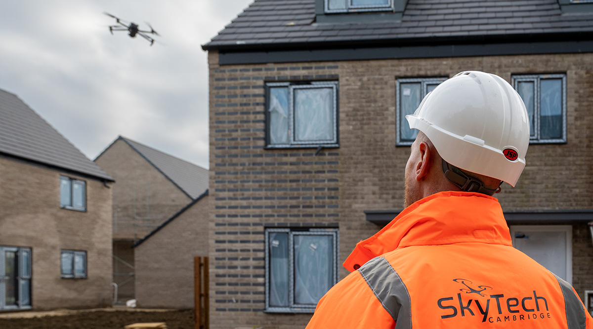
Drone survey and inspection
For roof, bridge, land or large building surveys and inspections - drones are quickly becoming the preferred choice for engineers, construction and asset managers for drone inspection and drone surveying because they offer great advantages in safety and speed of access.
Land surveys, aerial asset inspection and roof inspections all carry inherent risks using traditional methods. Using the latest commercial drone technology, Skytech Cambridge are able to complete timely and safe visual drone survey and drone inspection work while reducing traditional associated costs.
We can offer rapid deployment to carry out a comprehensive service at any location around the UK.
Every project is planned in detail beforehand to keep flight times to a minimum while ensuring that all relevant data is captured for post-flight analysis and reporting.
Drone and Ground based Photography and Videography
Delivering resolutions up to 8K and 120fps with our state of the art DJI Inspire 3 cinema drone, we can capture stunningly beautiful drone film and photography for any project. We also offer FPV drone filming for a modern and dynamic style of videography.